

Dragonfly enables the creation of district scale energy models through the use of an abstracted building geometry schema. Dragonfly models can be translated directly into detailed 3D Honeybee models but can also be simulated directly in a variety of engines. Energy simulations of Dragonfly models can be run with the URBANopt SDK, which leverages OpenStudio and EnergyPlus. Energy simulation results can be used to simulate loads on electrical electrical infrastructure with OpenDSS, and can also be incorporated into cost-optimization of renewables with REopt. Lastly, any dragonfly model can be used to morph rural EPW files to account for the urban heat island effect using the Urban Weather Generator (UWG).
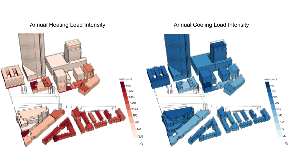
Simulate annual energy usage across entire urban districts and color geometry with heating and cooling intensity.
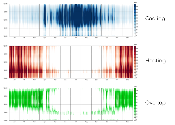
Understand opportunities for new district thermal systems that capitalize on the simultaneous need for heating and cooling across a district.
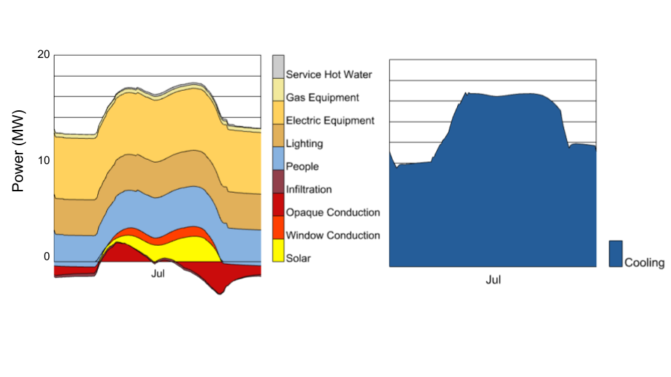
Model peak loads across an entire district to understand the factors driving the need for heating and cooling equipment.
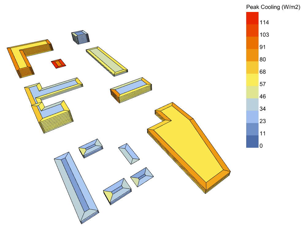
Model demand-response strategies over districts to understand their efficacy in reducing peak loads.
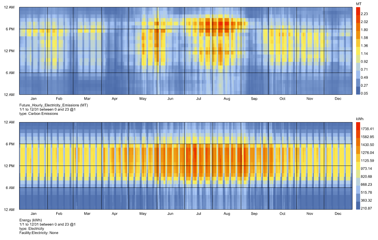
Forecast operational carbon emissions using a built-in data set of electric grid carbon intensity intensity for anywhere in the US.
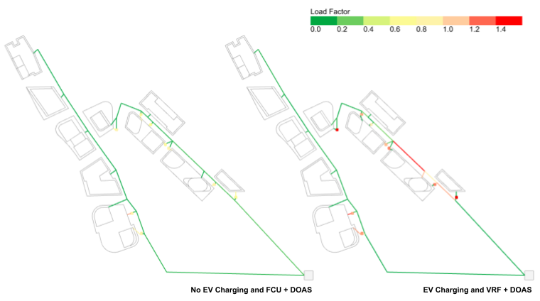
Model the loading of transformers and power lines to understand impacts of electrification scenarios.
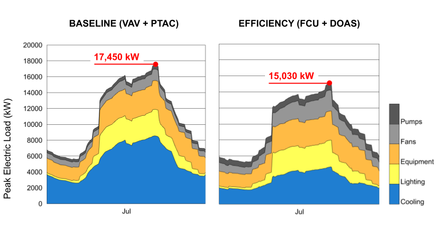
Model the impact of building retrofits on the need for electrical infrastructure to appropriately set up incentives.
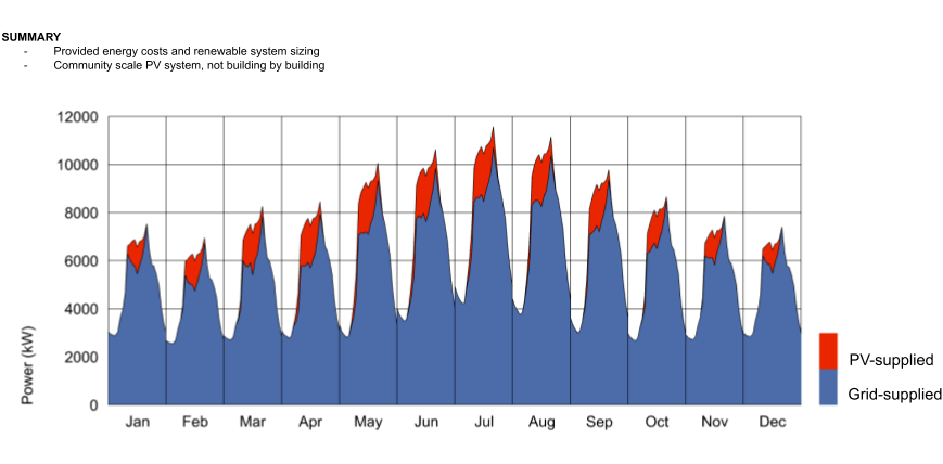
Perform cost-optimizations for investment in photovoltaics and battery storage across a district using the REopt Lite engine.
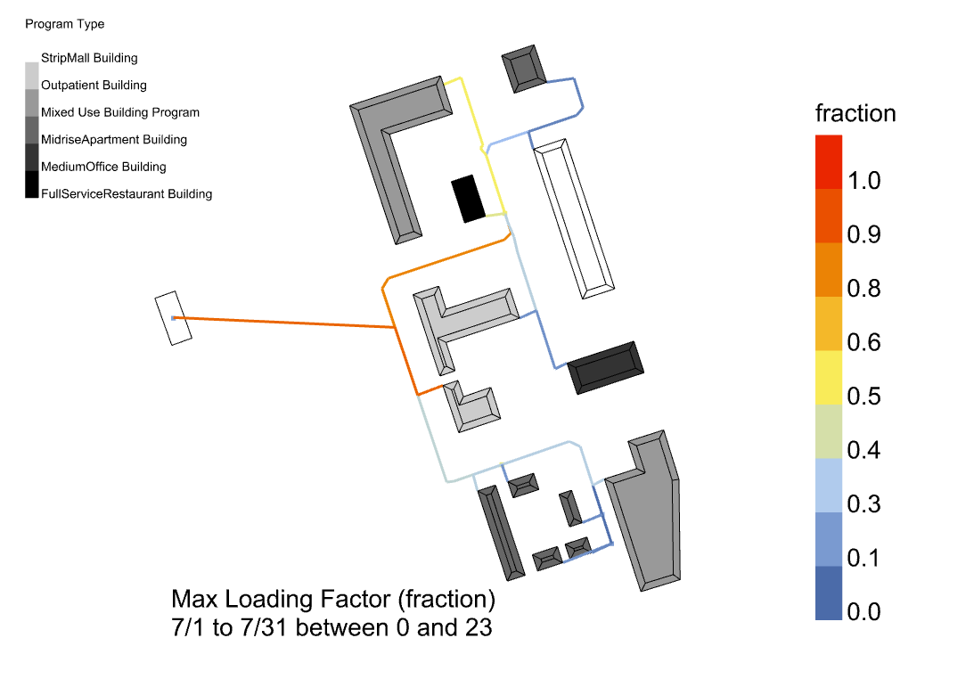
Autogenerate Reference Network Models (RNM) that depict the electrical infrastructure needed to meet buildings loads along a street network.
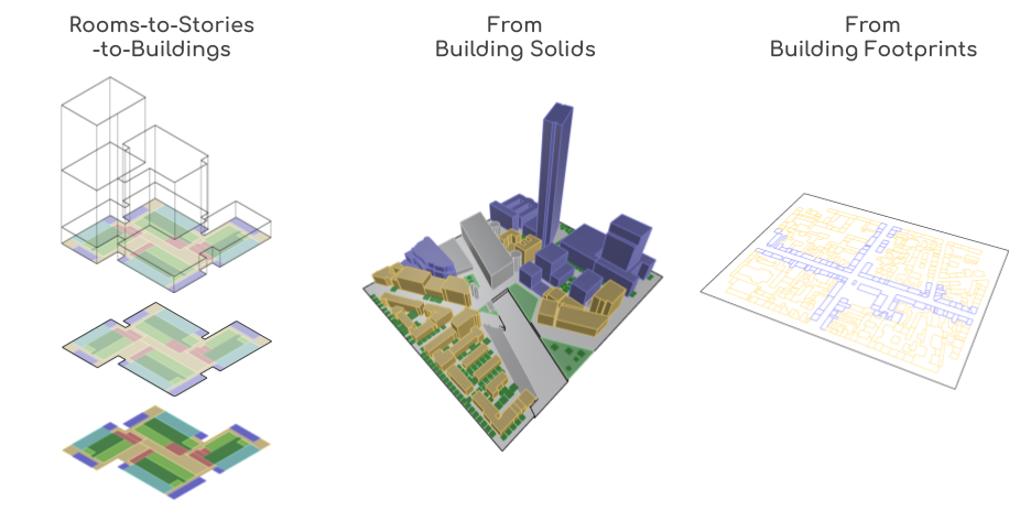
Construct district models from several different source geometries including:
- Detailed floor plans
- Solid building massing
- Building footprints
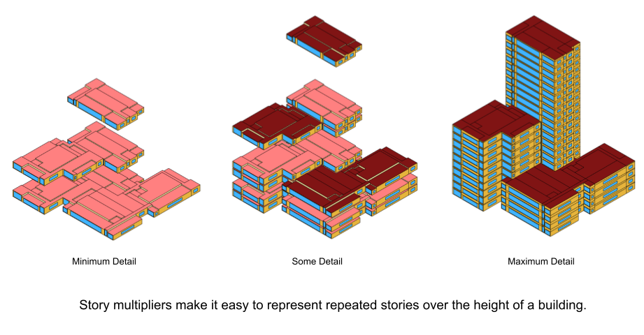
By representing stories and repeated geometries using multipliers, the level of detail in the resulting simulation can be tuned to balance accuracy and speed.
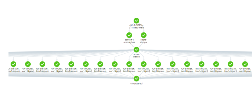
Export each building (or each story) to a separate energy model to run energy simulations with a high degree of parallelization.
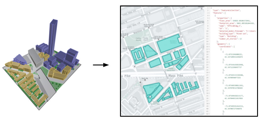
Export models to GeoJSON or construct new models starting from GeoJSON geometry.
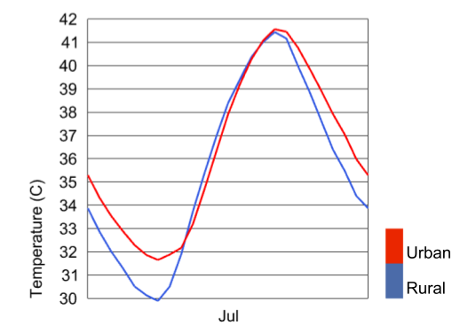
Morph EPW files to account for the urban heat island effect using urban geometry and properties.

Using publicly available data from the National Climatic Data Center, create EPW files for virtually any recent year for most locations on Earth.

Visualize publicly available thermal images and understand how temperatures vary over city-scales.